“No,” he replied in the same language.
“Have any of you been here before?” the Ranger asked.
“No. We’ve never been here before,” Brian said, leaning out of the passenger side of the taxi, the door open. I sat half awake in the back, Liz and Gino wedged in beside me. The taxi idled at the mouth of Carpathian National Park, which held Goverla, Ukraine’s highest mountain.
“Well, what will you do if you get lost?” the Ranger asked.
“We’ll take care of it,” said Brian.
“How will you take care it?” the Ranger asked incredulously.
“We won’t get lost,” said Brian with assurance. “I promise.”
The Ranger raised the horizontal bar serving as a gate and our taxi continued onward.
***
“Lost” can be a relative term, I suppose.
Did we know where we came from? Yes.
Did we know where we were going? No.
It should have been easy. I heard that over and over from people who had done Goverla: it’s easy.
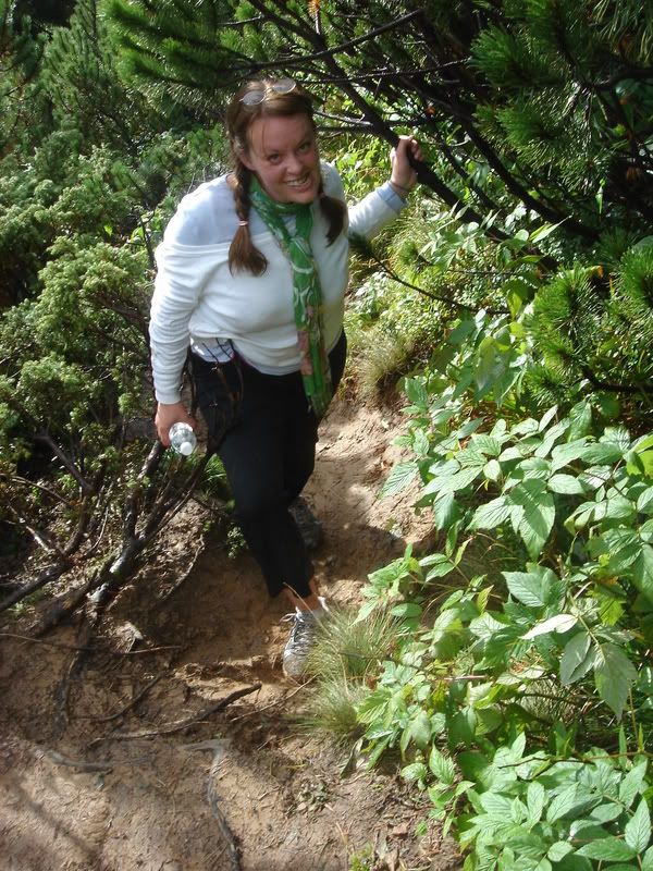
We piled out of the cab, cold. At the end of August in the mountains, it was colder than we expected. Brian and Gino were in a tee-shirts and Liz was in a long sleeved cotton shirt. Although Brian is the Eagle Scout, I seemed to be the only one prepared. I had on a fleece and a windbreaker, but I soon loaned the windbreaker to Gino. I was the only one who had eaten that morning, as well, having saved some yogurt and hard-boiled eggs from the previous day’s breakfast. It had been an early wake-up call: 5:15 AM for me, after a few hours of sleep from the good-bye party the night before. To tell the truth, I think I was still a little drunk.
A taxi had brought us, to the tune of 150 hrivna, from our hotel in Yaremcha to the base of Goverla, 37 KM away. It was the only way to get to the roof of Ukraine before we all had to catch a 6:00 PM train back to Kyiv.
We found a sign for Goverla with an arrow pointing at a wide, rock-strewn path.
It was 7:30 AM. Between the four of us we had one liter of water and the two hard-boiled eggs in my pocket. We began walking.
***
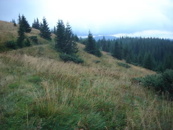
We started up the path, moving fast to stay warm, and enjoyed the sights: mountain rivers with planks of wood for bridges, yellow and purple flowers in bloom. Within half an hour we were above the tree line and walking into a Tolkien-esque fantasy: misty mountains, their rounded green tops draped in undulating fog. It was beautiful.
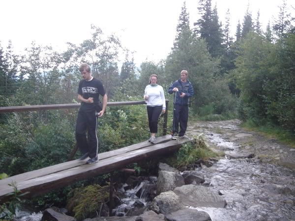
Gino, Liz and Brian crossing a bridge
We approached an old house of sorts, with a tin roof and wooden slats. Higher and behind it we reached a weather station, old and made of concrete blocks, things spinning on weather vanes and wires running everywhere.
We had also lost the trail.
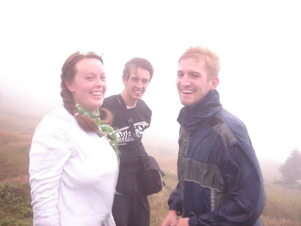
Brian spotted a man in boots and a huge purple parka attending to some of the instruments. He looked surprised to see us.
“Where is the path to Goverla?” asked Brian, who has the best Ukrainian among us. The rest of us lived in Russian or Surgic speaking towns and although we all had a descent understanding of the pure Ukrainian spoken in the west, we were embarrassed by our mangled attempts at speaking it.
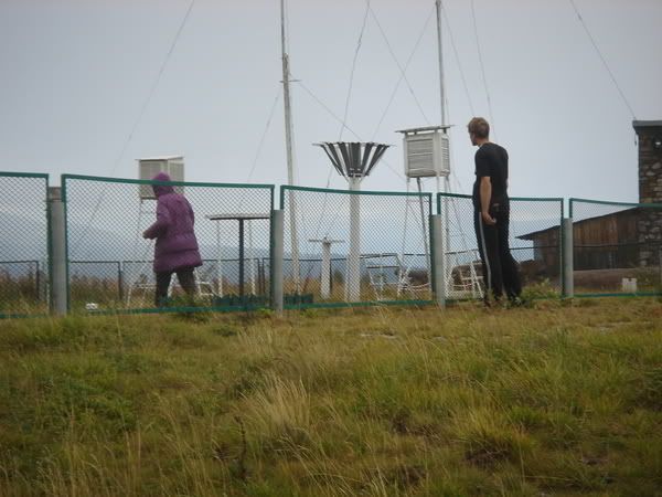
Brian and the purple-parked man
The man waved a hand vaguely to the right. “Goverla is over there,” he said. “You’re on the wrong mountain.”
The path that had led us here had been pretty well marked and whenever it branched, obvious red arrows spray-painted on the rocks and put us in the right direction. There was no way we could have gotten lost.
“Well, how do we get there?” asked Brian.
The man waved vaguely again. “Take the path up and then go across the ridge and you’ll get there,” said the man.
“What path?” asked Brian.
The man regarded Brian for a second. “Don’t go,” he said. “You’ll get lost and one of you will fall off a cliff and we’ll have to call an ambulance.”
Brian said nothing.
“And who seriously climbs a mountain in a tee-shirt?” he asked.
Brian turned and walked towards us.
We found the path he referred to, a thin dirt trail used so rarely that the short, shrubby bushes that grew at this altitude had spread their branches nearly completely across it. The rain of the past few days and the morning dew meant the path was muddy and the water on the branches transferred to our pants. The going was steep, all of us falling and sliding at some point, using the branches to pull ourselves up and keep our balance.
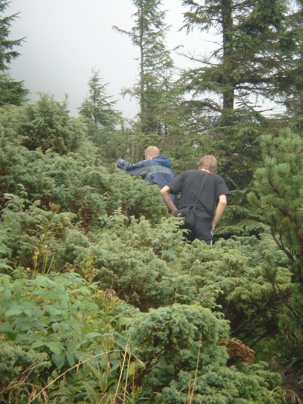
Up the path
Forty minutes of this later, finally hitting a plateau, we were soaked and caked in mud. The misty fog that looked so pretty from below now enveloped us, a wet, cold cloud. The mountains and trees no longer blocking the wind, it roared around us and the temperature dropped below freezing.
Brian had his arms inside his tee-shirt. The water in Liz’s hair froze into delicate icicles. I couldn’t feel my hands. But the going was now easier and the path snaked off in the right direction, so we followed it.
We couldn’t see where we were going: the fog was too thick, visibility only a few feet. We often lost sight of each other as we spread out along the path and called to each other to stay in contact. We would periodically regroup, but then our different gaits would spread us out again.
We had no idea where we were. We were on top of a mountain, that was for sure, but we could see nothing around us, could barely see each other, could only see the dirt path under our feet. Although the wind blew constantly, sometimes a gale of it would hit us at once, causing us to brace and see, as the gust blew some of the fog clear, that on our left the ridge of the mountain went up no more than thirty feet before ending at a bush-filled peak and that below us the land dropped away into a steep valley. I now knew what the man said about falling off a cliff.
We kept walking, not knowing where we were going, picking forks in path by intuition more than anything. Then the path all but disappeared. We were following a line of slightly trampled grass, moving in a straight line when even that vanished, hoping to find something more substantial.
The water had been drunk. I had long ago eaten the eggs.
Were we lost? It’s a relative question. Besides, Brian had a promise to keep.
We kept walking.
We could have been half an hour from Goverla, ten minutes away, maybe we were on it. Maybe we were on the wrong path completely. I knew a path wended its way on these mountain tops for more than 40 km, all the way to an old observatory built by the Poles. Maybe we were on that path. Who knew?
If it had been a clear day it would have been easy. That high up we could have spotted the cross I knew to be on top of Goverla, or at least sighted which crest was the highest. We could see absolutely nothing and were shivering and stumbling around on top of a wind-blown ridgeline.
We knew how to get back: turn around. We just didn’t know where we were going. Had Brian broken his promise? It’s academic.
Since I had rounded up the crew for this hike, it fell to me to call it, like a patient dead on the table. There is a point where it becomes to stupid too keep doing what you are doing. And lost on top of a unknown mountain in the Carpathians, shrouded in fog, freezing in tee-shirts, without food and water and no idea how to get where we were going had definitely crossed the stupidity threshold.
We found our way back, retracing our steps along the ridgeline. We were about to start heading downhill again when I found another path leading higher. The three stayed while I explored it and found a path that had seen some use: packed dirt and bits of trash. I came back down and found that the others had spotted a wooden sign in the fog, up near the path I had taken.
Finally! A sign.
Up we went, along that path and found that sign, which had so many boards nailed to its wooden post that it looked like those that point the ways to different, distant cities.
There was no writing whatsoever on it. It was a blank marker up in the mountains, marking absolutely nothing.
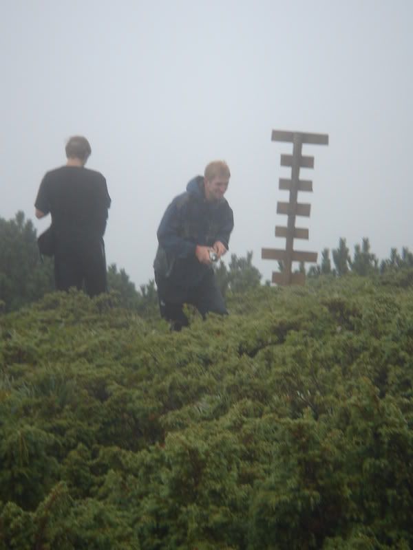
The sign with nothing on it
We huddled like penguins, facing each other in a circle while we tried to send text messages, slowly typing out in frozen fingers. I texted my friend Heron, who had done the trail before: “did you see a sign with many boards and no writing?”
Her response: “no, are you above the trees yet?”
We’d been above the trees for more than an hour, but it was obvious we weren’t where we needed to be.
And if anyone is wondering, a penguin huddle really does work. Sharing our body heat like that, we stopped shivering for a few minutes.
Curiously, no one was unhappy. Slipping and sliding around on the mud and being lost had a “so ridiculous it’s funny” quality, and we had never stopped cracking jokes to each other. “This is better,” we said. “Climbing Goverla is easy, at least we had an experience to show for it.”
We headed back down.
I wondered at that going down. Although certainly difficult, Everest is such a popular destination that an infrastructure of fixed ropes and ladders is in place, an entire economy of porters and portable oxygen at its base. At this point, it’s probably harder to climb any of the peaks around Everest, a thousand feet or more shorter but carving the way by yourself.
I now forget the name of the mountain we climbed. I found out the name later, but only remember that it starts with a “B”. I suppose that’s beside the point. The point was we got to the top of a mountain and while 300 feet shorter than Goverla, it was a hell of a lot harder, which made it a hell of a lot cooler.
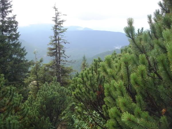
The lower we went, the less miserable it became. Once out of the clouds we finally had visibility, the temperature got warmer, trees blocked the wind. Brian’s arms sprouted out of his tee-shirt. An hour later we were at the bottom and still could not figure out how we had gotten “lost” in the first place.
The sign to Goverla still pointed to our path and there had been no diverting paths that we had missed. Brian finally saw it: around a building that was part of the nearly-abandoned hotel at the bottom of the mountain was another path, a big one, with a big sign in both English and Ukrainian and red/white/red blazes spray painted on the trees.
Now that was a path and it was obviously the path to Goverla.
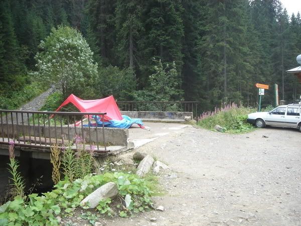
On the right is the tiny orange sign pointing to the Goverla path. Notice that it is point to the right. It should be pointing at me, because I was standing on the real Goverla path when I took this picture
I looked back up at the sign pointing to our path. I reached up and lightly pushed on it. It effortlessly swung and now pointed the right way.